


Calgary Sequence Stratigraphy Stampede- Basic Concepts and Applications | July 11-15

Sequence Stratigraphy - Basic Concepts and Applications. The sequence stratigraphic method was developed to support geoscientists with the geologic interpretation of subsurface data. This method is utilized to predict the presence of petroleum play elements and to assess their quality before drilling. Sequence stratigraphy is applied to core, outcrop, well logs as well as 2-D and 3-D seismic lines across all depositional environments. This course reviews basic definitions and terminology of surfaces and systems tracts and introduces the sequence stratigraphic hierarchy. Training exercises and datasets are thoroughly discussed, and participants later interpret subsurface data in non-marine, shallow marine, and deep-marine depositional settings within a sequence stratigraphic framework. Based on the sequence stratigraphic method, the recognition and mapping of play elements from exploration to production scales is emphasized in this course.
Learning Outcomes:
• Explain development of sequence stratigraphic concepts
• Define basic sequence stratigraphic terms
• Interpret facies and facies stacking patterns to map coeval depositional systems
• Implement the concept of facies, facies stacking and shoreline trajectory to identify parasequences, systems tracts and stratigraphic surfaces
• Differentiate the main controls on depositional sequences
• Recall the sequence stratigraphy hierarchy
• Interpret core, outcrop, well-logs, and seismic lines
• Apply the sequence stratigraphic method in non-marine, shallow marine and deep marine environments
• Recognize and map hydrocarbon play elements across different depositional settings
Course Content:
• Lithostratigraphy vs. chronostratigraphy interpretations
• Fundamentals of sequence stratigraphy
• Well-log interpretation, correlation, and mapping
• Seismic response of key stratigraphic surfaces
• Seismic reflection termination mapping and seismic facies analyses
• Accommodation succession method
• Hydrocarbon play element recognition and mapping
• Criteria and mapping strategies for play elements in non-marine, shallow-marine, and deep-marine depositional settings

London Sequence Stratigraphy - Basic Concepts and Applications
Sequence Stratigraphy - Basic Concepts and Applications. The sequence stratigraphic method was developed to support geoscientists with the geologic interpretation of subsurface data. This method is utilized to predict the presence of petroleum play elements and to assess their quality before drilling. Sequence stratigraphy is applied to core, outcrop, well logs as well as 2-D and 3-D seismic lines across all depositional environments. This course reviews basic definitions and terminology of surfaces and systems tracts and introduces the sequence stratigraphic hierarchy. Training exercises and datasets are thoroughly discussed, and participants later interpret subsurface data in non-marine, shallow marine, and deep-marine depositional settings within a sequence stratigraphic framework. Based on the sequence stratigraphic method, the recognition and mapping of play elements from exploration to production scales is emphasized in this course.
Learning Outcomes:
• Explain development of sequence stratigraphic concepts
• Define basic sequence stratigraphic terms
• Interpret facies and facies stacking patterns to map coeval depositional systems
• Implement the concept of facies, facies stacking and shoreline trajectory to identify parasequences, systems tracts and stratigraphic surfaces
• Differentiate the main controls on depositional sequences
• Recall the sequence stratigraphy hierarchy
• Interpret core, outcrop, well-logs, and seismic lines
• Apply the sequence stratigraphic method in non-marine, shallow marine and deep marine environments
• Recognize and map hydrocarbon play elements across different depositional settings
Course Content:
• Lithostratigraphy vs. chronostratigraphy interpretations
• Fundamentals of sequence stratigraphy
• Well-log interpretation, correlation, and mapping
• Seismic response of key stratigraphic surfaces
• Seismic reflection termination mapping and seismic facies analyses
• Accommodation succession method
• Hydrocarbon play element recognition and mapping
• Criteria and mapping strategies for play elements in non-marine, shallow-marine, and deep-marine depositional settings

CARB 609 - Carbonate Reservoir Architecture, Mallorca/Menorca
This field trip gives a detailed understanding of the controls on the development of carbonate reservoirs. The influences of biota and sea level change on the facies, architecture, and reservoir characteristics of ramp and reef systems are examined. Participants will gain an understanding of the processes driving carbonate systems to reduce uncertainties in the prediction of subsurface facies and porosity distribution. The learning objectives can be applied to the entire exploration and production life-cycle to better predict carbonate reservoir potential, conduct better volumetric assessments, and create improved reservoir models.

DWCS 502 - Sequence Stratigraphic Controls on Deepwater Reservoirs
From Vitor Abreu-
Unlike continental and shallow-marine depositional environments, deepwater depositional systems develop in remote, difficult to access locations that prevent more direct observations of sedimentary processes and resulting depositional architecture. Therefore, outcrop analogues are even more important to observe and learn from, in order to support de-risking costly exploration projects, for example by assessing reservoir presence risk, net-to-gross predictions and reservoir connectivity.
Also, vertical scales of 10 to 20 meters are often below seismic resolution, making it difficult to predict in that scale facies variations occurring in distances of 1 to 2 kilometers, which are common well-spacings in production deep-water projects. Seismic-scale outcrops like the ones from the Brushy Canyon Formation help fill this gap in showing lateral and vertical variations in facies in scales that are not represented by data using conventional, industry seismic and wells.
This field course is designed for geoscientists and engineers exploring for and producing deepwater (DW) reservoirs globally, and particularly in the Permian Basin. At the end of this course, participants should have improved abilities to recognize deep-water depositional facies and reservoir architecture, as well as how to use sequence stratigraphy to identify and map key surfaces for DW exploration.
The Guadalupe and Delaware mountains in west Texas and New Mexico show unique, world-class exposures of shelfal to slope and basinal settings with seismic-scale, continuous exposures. These exceptional outcrops are ideal to learn about depositional systems, lateral and vertical variations in facies and sequence stratigraphic architecture and surfaces. Coeval shelfal to deep-water environments are exposed both downdip and along strike, with clear stratigraphic relationships from a carbonate shelf margin incised by canyons, feeding confined to weakly confined channel systems, connected to distributive lobe complexes and distal fan fringe sandstones that thin and pinch out onto a basin margin far removed from siliciclastic sediment sources.
Participants will learn:
1. To recognize main archetypes of deep-water-reservoirs, relating them to exploration strategies and production behavior
2. How to interpret key stratigraphic surfaces based on changes in lithofacies stacking and associations.
3. How to interpret DW EoD’s based on lithofacies associations, stacking and diversity
4. How to use outcrop analogues and depositional models to better understand 3-D distribution of reservoir facies.
5. To analyze exposures of carbonate shelf and ramp to siliciclastic basinal systems in order to relate depositional facies to seismic scale geometries and sequence stratigraphy.
6. To examine seismic scale outcrop geometries, document outcrop facies, and demonstrate similarities to productive intervals in the Permian Basin.
7. To apply Walter’s Law and chronostratigraphic principles in core, well-log and seismic interpretation, and relate to prediction of play elements and best productive intervals for unconventional resources.
8. To analyze sequence stratigraphy for carbonates and mixed carbonate-clastic depositional systems.

STRC 701 - Structural Geology for Petroleum Exploration
Taught by the legendary, charismatic, and electric Lans Taylor, this field course starts in Las Vegas. Participants will stay east of town in Henderson, Nevada and head out to field areas learning about all of the structural styles as well as regional geological context.
Lans in Action -
This course examines aspects of structural interpretation in extensional, inversion and thrust tectonic regimes, from outcrop to regional scale. The field course focuses on outcrop analogs, petroleum industry case studies, seismic exercises and scaled analogue modelling examples.
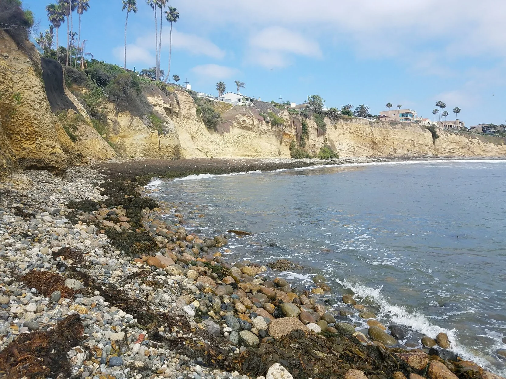
DWCS 504b - Reservoir Architecture of Deep Water Systems
Join us in San Diego to visit world class outcrops with the incomparable and brilliant Vitor Abreu
From Vitor Abreu:
Submarine canyons and deepwater channels are the primary conduits for the transfer of coarse sediments from the shelf to deep water fans and are major exploration targets. The evolution of southern California included many episodes of deep water sedimentation in settings ranging from a Paleozoic cratonic passive margin to Mesozoic forearc and arc settings to Cenozoic transform, pull-apart, and continental borderland basins. This course will examine six deep water systems in which large and small submarine channels and fans played major roles as sediment transport routes and sites of sedimentation.
Participants will learn to:
Assess sedimentological processes of deep water deposition and erosion and their impact in reservoir architecture.
Interpret cores, well logs and outcrops using appropriate deep water lithofacies nomenclature and definitions.
Describe deep water lithofacies in cores and relate them to stratal geometries.
Interpret key stratigraphic surfaces based on changes in lithofacies stacking and associations.
Interpret deep water environments of deposition based on lithofacies associations, stacking and diversity.
Use outcrop analogues and depositional models to better understand 3-D distribution of reservoir facies.
Tie rock properties to facies in building geologic models.
Perform environment of deposition mapping, emphasizing impact on reservoir performance and behavior.
Evaluate core, well-logs and seismic data to describe the reservoir in 3 dimensions.
This 5-day course combines field activities with class lectures and exercises, with 80% of the time spent in the field. Exercises in the field will focus on description of deepwater lithofacies, stratal geometries and recognizing key stratigraphic surfaces, emphasizing practical applications. Participants will also learn to describe cores, integrate core and well-log information with seismic to generate high-resolution environment of deposition maps of reservoirs in different settings. Engineering data are used to demonstrate how to improve prediction of reservoir performance. Cores, well-logs and seismic examples are compared to and contrasted with outcrops to help participants to extrapolate 2-D outcrop information to 3-D views of reservoir scale depositional systems.

Big Bend Annual Winter Is Coming Geology Tour of Fire and Ice West Texas Retreat and Camping Event
13th depart Houston 5am, (1pm check in at Chisos Basin), Arrive 4pm, Sunset hike
14th Ascend Emory peak and explore the Chisos Basin
15th Drive to the Western part of the park: Santa Elena, Tuff canyon, Mules Ears, Terlingua
16th West side of the park, Boquillas Canyon (optional border crossing), hotsprings, Rio grande village
17th Breakdown camp, check out 10am return to Houston by 8pm


Field Course: Sequence Stratigraphic Controls on Deep-Water Reservoir Architecture: Brushy Canyon Formation, Permian Basin (West Texas & New Mexico)
This field course is designed for geoscientists and engineers exploring for and producing deep-water(DW) reservoirs globally, and particularly in the Permian Basin. At the end of this course, participants should have improved abilities to recognize deep-water depositional facies and reservoir architecture, as well as how to use sequence stratigraphy to identify and map key surfaces for DW exploration. The Guadalupe and Delaware mountains in west Texas and New Mexico show unique, world-class exposures of shelfal to slope and basinal settings with seismic-scale, continuous exposures. These exceptional outcrops are ideal to learn about depositional systems, lateral and vertical variations in facies and sequence stratigraphic architecture and surfaces. Coeval shelfal to deep-water environments are exposed both downdip and along strike, with clear stratigraphic relationships from a carbonate shelf margin incised by canyons, feeding confined to weakly confined channel systems, connected to distributive lobe complexes and distal fan fringe sandstones that thin and pinch out onto a basin margin far removed from siliciclastic sediment sources.


Cabin building in Maine
This has 0 business significance, but maybe you’ll find it useful to know I’ll be out of Texas.

Hikes with Mike - Big Bend
Explore Big Bend with a Certified G (eologist) who has years of experience working the area AND teaching humans about it.
Join us for an all inclusive expedition to hunt rocks and understand Big Bend National Park better than you ever have before.
We’ll see many of the popular beautiful sights but also explain why they are there and dive in to what makes them special.
From hot springs to dinosaur fossils to the brilliant night sky- you’ll find something to love.
DWCS 504 - Reservoir Architecture of Deep Water Systems
Join us in San Diego to visit world class outcrops with the incomparable and brilliant Vitor Abreu
Podcast Episode- https://www.buzzsprout.com/926575/4147928

STRC 701 - Structural Geology for Petroleum Exploration
Taught by the legendary, charismatic, and electric Lans Taylor, this field course starts in Las Vegas. Participants will stay east of town in Henderson, Nevada and head out to field areas learning about all of the structural styles as well as regional geological context.

